Windows
Mac
Windows
Log in / Sign up
Windows
›
Tags › GIS tool
Most popular
GIS Tool
software
Relevance
Popularity
Rating
ArcGIS for Desktop Update GeoPackage Support for OGC Standard Patch
free
49
Environmental Systems Research Institute, Inc.
This patch upgrades ArcGIS Desktop and Server support for the 1...
This patch upgrades ArcGIS Desktop and Server support for the 1.0 version of the GeoPackage
ArcGIS for Desktop Non-textured Multipatch Transparency Patch
free
44
Environmental Systems Research Institute, Inc.
ArcGIS for Desktop Non-textured Multipatch Transparency Patch is a free patch...
issue of the Transparency
tool
on the 3D Effects
ArcGIS for Desktop Updated CityEngine Geoprocessing Tools Patch
31
Environmental Systems Research Institute, Inc.
ArcGIS for Desktop Updated CityEngine Geoprocessing Tools Patch is a program that adds support...
Updated CityEngine Geoprocessing
Tools
Patch...the CityEngine geoprocessing
tools
MI Streetview
free
28
Polygon GIS
As it’s name suggests the tool allows you to view Google Streetview from inside MapInfo Professional...
MapInfo Professional 9.5 . The
tool
is quite...session. Click the
tool
and then click
JMARS
free
24
Mars Space Flight Facility, Arizona State University
JMARS is an acronym that stands for Java Mission-planning and Analysis for Remote Sensing. It is a geospatial...
geospatial information system (
GIS
) developed by ASU's...and data-analysis
tools
to NASA's
ET GeoTools Concurrent for ArcGIS
23
ET SpatialTechniques
ET GeoTools Concurrent for ArcGIS can increase the editing productivity in ArcMap, give enhanced editing...
topologically correct datasets. The
tools
are designed
TerraGo Publisher for ArcGIS
23
TerraGo Technologies
TerraGo Publisher for ArcGIS enables organizations to significantly enhance the value of their existing GIS...
value of their existing
GIS
systems by producing
ArcGIS for Desktop Parcel Fabric General Maintenance Update Patch
17
Environmental Systems Research Institute, Inc.
This patch fixes data corruptions resulting from certain edits in the parcel traverse grid, certain cases where line points...
Parcel Remainder
tool
and the Name Parcel
tool
ManageBGL
14
DataMystic
Save the lives of diabetic kids overnight by predicting blood sugar levels 8 hours ahead...
provides cutting-edge
tools
for managing...Low, Medium and High
GI
foods)
SuperGIS Server
7
SuperGeo
SuperGIS Server is a comprehensive and server-based GIS, designed for giving...
and server-based
GIS
, designed for giving...
GIS
resources, such as maps, globes, geodatabases and
tools
ATDI Global Mapper Plug-in
7
ATDI Limited
Global Mapper is a GIS tool for map data format conversion. ATDI have developed the Global...
Global Mapper is a
GIS
tool
for map...Warfare and ICS Basic
tools
with a few clicks
Sampling Design Tool
free
3
Center for Coastal Monitoring and Assessment
The Biogeography Branch’s Sampling Design Tool for ArcGIS provides users a means to efficiently sample...
’s Sampling Design
Tool
for ArcGIS provides...in a
GIS
environment. The
tool
was created
PSS/SINCAL
2
Siemens
These tools are used in operational power system simulation as well as model exchange...
model exchange. The
tools
enable the coordination...SCADA, EMS, DMS,
GIS
and Metering Data Management
XP-Rafts
1
XP Software Inc.
Xprafts has improved upon the original with additional features and enhancements that will revolutionize...
your CAD drawings or
GIS
files to create a scaled
1
2
3
4
5
6
7
Tags
Tool
ArcGIS patch
GIS systems tool
GIS systems helper
ArcMap tool
ArcMap functionality
Share GIS resources
ArcMap topologically
Geo databases
ArcGIS fixer
Featured stories
See all
Best Online Education Tools for Teachers and Students
In the new era of learning, technology plays a fundamental role in the processes of teaching. Here are 5 best online tools that can help teachers and students.
Best time-management tools to use in 2022
We’ve rounded up the best time-management software available to organize your time more efficiently and work more effectively.
Microsoft limits access to its emotion recognition AI tools
Microsoft has announced that it will no longer sell face recognition technologies. The company also restricts access to facial recognition AI tools.
Top 10 open-source tools in 2022
We’ve compiled a list of what we consider to be the best open-source tools you can get in 2022.
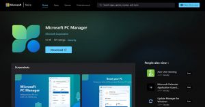
Spotlight: Microsoft PC Manager, Windows optimization tool
In case you did not know, Microsoft does have a system cleaner of its own, and its latest version is good enough to rival CCleaner and other leaders of this domain.